Coventry Canal north-east of Hartshill in Warwickshire
Introduction
The photograph on this page of Coventry Canal north-east of Hartshill in Warwickshire by Roger Kidd as part of the Geograph project.
The Geograph project started in 2005 with the aim of publishing, organising and preserving representative images for every square kilometre of Great Britain, Ireland and the Isle of Man.

There are currently over 7.5m images from over 14,400 individuals and you can help contribute to the project by visiting https://www.geograph.org.uk
Coventry Canal north-east of Hartshill in Warwickshire
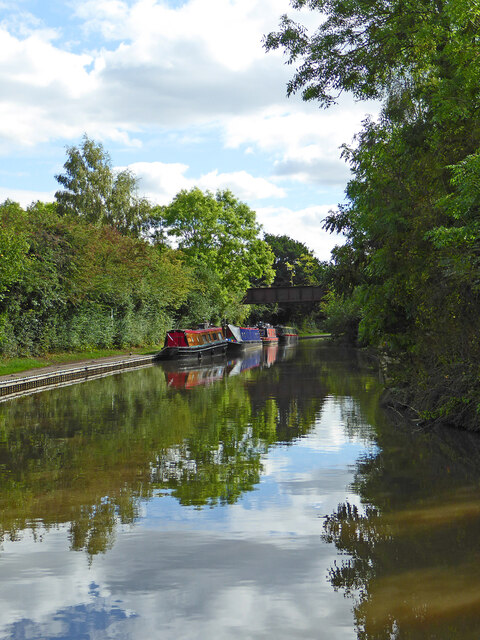
Image: © Roger Kidd Taken: 22 Sep 2016
Looking south-east as the canal meanders towards Nuneaton. The disused inclined bridge ahead originally carried a tramway to transport stone from the Hartshill Quarries (off to the right) to the main line railway, off to the left. No public right of way exists on it.
Images are licensed for reuse under creativecommons.org/licenses/by-sa/2.0
Image Location


Leaflet Map data © OpenStreetMap
Latitude
52.548309
Longitude
-1.506375