The Coltishall Island
Introduction
The photograph on this page of The Coltishall Island by Evelyn Simak as part of the Geograph project.
The Geograph project started in 2005 with the aim of publishing, organising and preserving representative images for every square kilometre of Great Britain, Ireland and the Isle of Man.

There are currently over 7.5m images from over 14,400 individuals and you can help contribute to the project by visiting https://www.geograph.org.uk
The Coltishall Island
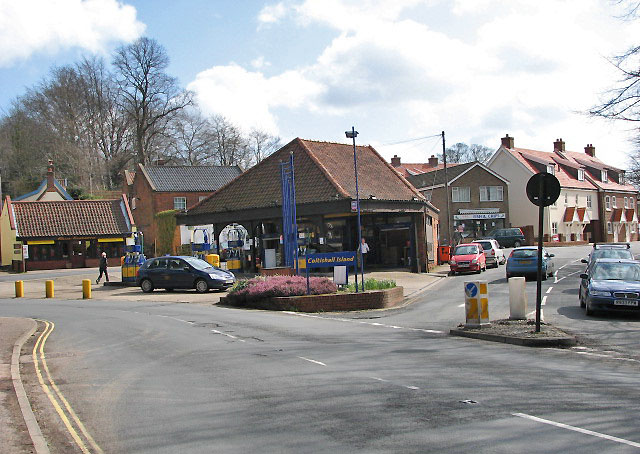
Image: © Evelyn Simak Taken: 29 Mar 2008
Where High Street, Norwich Road (B1150) and Church Street meet; the view is east from the B1150, towards the petrol station in the centre. During the 18th and 19th centuries Coltishall, situated on the River Bure, was a prosperous village where wherry builders and maltsters successfully plied their trades. The railway, which arrived in 1879, brought more visitors to the Broads and the fashionable brick houses that line High Street, Church Street and Wroxham Road date from this time. When the local industries closed in the early 1900s - the last wherry was built in 1920 and the last malt house closed in 1927 - many of the shops closed as well.
Images are licensed for reuse under creativecommons.org/licenses/by-sa/2.0
Image Location
Latitude
52.728162
Longitude
1.357574