Old Bridge Marker on Bury and Rochdale Old Road, Heywood
Introduction
The photograph on this page of Old Bridge Marker on Bury and Rochdale Old Road, Heywood by N Upton as part of the Geograph project.
The Geograph project started in 2005 with the aim of publishing, organising and preserving representative images for every square kilometre of Great Britain, Ireland and the Isle of Man.

There are currently over 7.5m images from over 14,400 individuals and you can help contribute to the project by visiting https://www.geograph.org.uk
Old Bridge Marker on Bury and Rochdale Old Road, Heywood
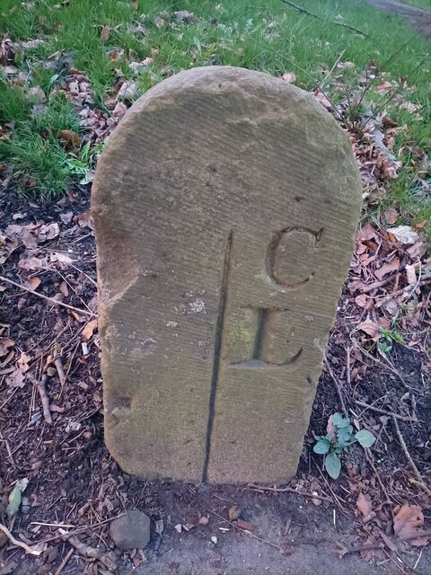
Image: © N Upton Taken: 4 Mar 2023
County Bridge Marker on the south side of the B6222 Bury and Rochdale Old Road in Heywood, 100 metres east of Simpson Clough Bridge. The stone marks the extent of roadway adjoining the bridge that the County was obliged to maintain. Milestone Society National ID: LA_HEYW02br
Images are licensed for reuse under creativecommons.org/licenses/by-sa/2.0
Image Location
Latitude
53.604496
Longitude
-2.223473