Old milestone
Introduction
The photograph on this page of Old milestone by Chris Minto as part of the Geograph project.
The Geograph project started in 2005 with the aim of publishing, organising and preserving representative images for every square kilometre of Great Britain, Ireland and the Isle of Man.

There are currently over 7.5m images from over 14,400 individuals and you can help contribute to the project by visiting https://www.geograph.org.uk
Old milestone
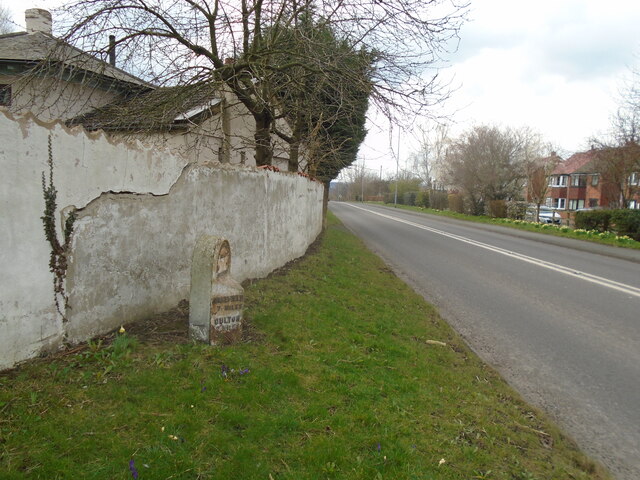
Image: © Chris Minto Taken: 5 Mar 2023
Looking along the A642 road towards Oulton and Wakefield. A cut benchmark can be seen near the base of the stone. When these milestones were set up the stone was left bare but many have been given a coat of white or black paint during the last 130 years. There was a 12 mile long tollroad between Wakefield and Aberford first enacted in 1741 but no older milestones have been found and only 4 of the WRCC ones are still in situ.
Images are licensed for reuse under creativecommons.org/licenses/by-sa/2.0
Image Location
Latitude
53.765502
Longitude
-1.423346