Moor Lane, Chessington
Introduction
The photograph on this page of Moor Lane, Chessington by Malc McDonald as part of the Geograph project.
The Geograph project started in 2005 with the aim of publishing, organising and preserving representative images for every square kilometre of Great Britain, Ireland and the Isle of Man.

There are currently over 7.5m images from over 14,400 individuals and you can help contribute to the project by visiting https://www.geograph.org.uk
Moor Lane, Chessington
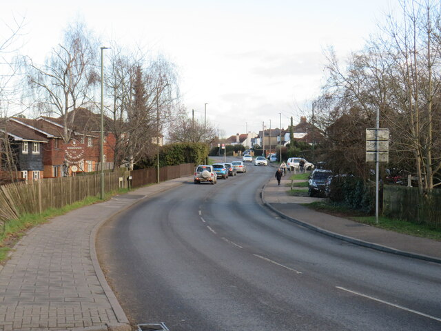
Image: © Malc McDonald Taken: 25 Feb 2023
Moor Lane is a road in Chessington, on the fringe of south west London. Here, the road crosses the boundary from Greater London into Surrey, leaving Chessington and entering West Ewell. The sign for the Borough of Epsom and Ewell stands to the left of the road. At this point, the road name changes to Chessington Road. This image was taken in the month of February. Trees were bare for the winter season.
Images are licensed for reuse under creativecommons.org/licenses/by-sa/2.0
Image Location
Latitude
51.362107
Longitude
-0.288417