Knaresborough, Waterside
Introduction
The photograph on this page of Knaresborough, Waterside by Mel Towler as part of the Geograph project.
The Geograph project started in 2005 with the aim of publishing, organising and preserving representative images for every square kilometre of Great Britain, Ireland and the Isle of Man.

There are currently over 7.5m images from over 14,400 individuals and you can help contribute to the project by visiting https://www.geograph.org.uk
Knaresborough, Waterside
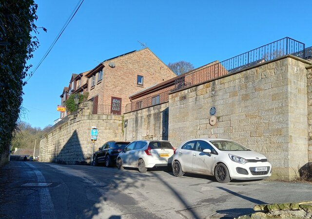
Image: © Mel Towler Taken: 19 Jan 2023
There is a benchmark cut into the roadside wall on the north side of Waterside and the river. The cutmark is on a left cornerstone, behind the 2nd white car.
Images are licensed for reuse under creativecommons.org/licenses/by-sa/2.0
Image Location
Latitude
54.003983
Longitude
-1.469031