Old Boundary Marker on Mossley Road, Hazelhurst
Introduction
The photograph on this page of Old Boundary Marker on Mossley Road, Hazelhurst by N Upton as part of the Geograph project.
The Geograph project started in 2005 with the aim of publishing, organising and preserving representative images for every square kilometre of Great Britain, Ireland and the Isle of Man.

There are currently over 7.5m images from over 14,400 individuals and you can help contribute to the project by visiting https://www.geograph.org.uk
Old Boundary Marker on Mossley Road, Hazelhurst
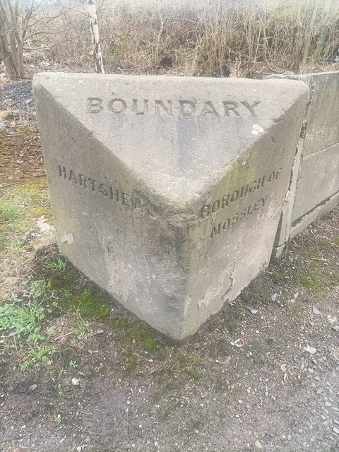
Image: © N Upton Taken: 1 Jan 2009
Municipal Boundary Marker at the end of a concrete wall on the east side of the A670 Mossley Road in Hazelhurst. Previously Ashton under Lyne parish until 1894, then on the boundary of Hartshead parish, created 1894, and Mossley borough and parish. Now entirely in Tameside. See also https://www.geograph.org.uk/photo/1426854. Milestone Society National ID: LA_HARMOS01pb
Images are licensed for reuse under creativecommons.org/licenses/by-sa/2.0
Image Location
Latitude
53.503087
Longitude
-2.058201