Whitehaven Station
Introduction
The photograph on this page of Whitehaven Station by Adrian Taylor as part of the Geograph project.
The Geograph project started in 2005 with the aim of publishing, organising and preserving representative images for every square kilometre of Great Britain, Ireland and the Isle of Man.

There are currently over 7.5m images from over 14,400 individuals and you can help contribute to the project by visiting https://www.geograph.org.uk
Whitehaven Station
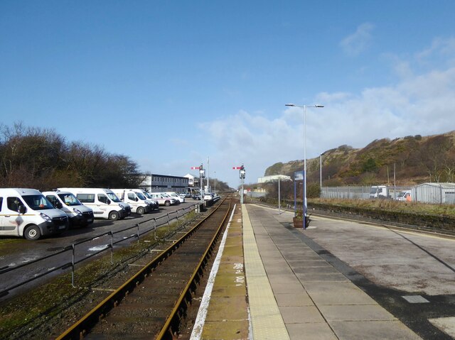
Image: © Adrian Taylor Taken: 21 Feb 2022
Platform 1 at Whitehaven Station. The railway had been closed due to Storm Franklin causing the sea to wash over the track and it had been reopened shortly before this photograph was taken. The only train so far had been a southbound (up) train to Barrow-in-Furness using Platform 2, hence the rusted track. Note the fleet of Network Rail maintenance vans.
Images are licensed for reuse under creativecommons.org/licenses/by-sa/2.0
Image Location
Latitude
54.553732
Longitude
-3.587579