King George's Place
Introduction
The photograph on this page of King George's Place by Ian Capper as part of the Geograph project.
The Geograph project started in 2005 with the aim of publishing, organising and preserving representative images for every square kilometre of Great Britain, Ireland and the Isle of Man.

There are currently over 7.5m images from over 14,400 individuals and you can help contribute to the project by visiting https://www.geograph.org.uk
King George's Place
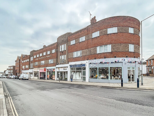
Image: © Ian Capper Taken: 28 Jan 2023
Brick block in "modern" style designed by David E Nye and built 1934-5 at the junction of High Street and Wantz Road. The building replaced a 19th Century fronted timber framed 15th Century house originally named Hardings, later The Trees (the name which is shown on the 1875 1:500 Town Plan). At the far of King George's Place originally stood the art deco Embassy Cinema, also designed by Nye, which opened in 1936 but was demolished in 1985 and replaced by a retirement complex named Embassy Court, the gables of which can be seen towards the left of the photo.
Images are licensed for reuse under creativecommons.org/licenses/by-sa/2.0
Image Location
Latitude
51.73034
Longitude
0.682123