Bwlch y Gwynt
Introduction
The photograph on this page of Bwlch y Gwynt by Eirian Evans as part of the Geograph project.
The Geograph project started in 2005 with the aim of publishing, organising and preserving representative images for every square kilometre of Great Britain, Ireland and the Isle of Man.

There are currently over 7.5m images from over 14,400 individuals and you can help contribute to the project by visiting https://www.geograph.org.uk
Bwlch y Gwynt
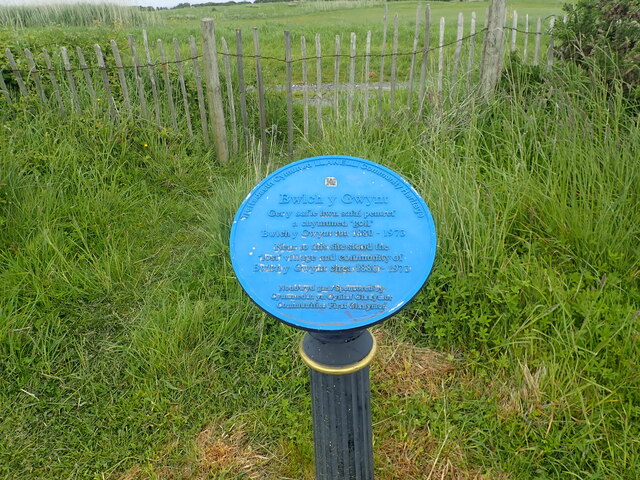
Image: © Eirian Evans Taken: 22 May 2022
Plaque commemorating the "lost" village of Bwlch y Gwynt. The village consisted of workers houses that had been built for the workforce of the tinplate works which were erected at Machynys in the late 19th century. These tinplate works closed in 1961 after a huge new factory was built in Trostre. The villagers were evicted and the houses were earmarked for demolition, though the houses were not demolished until 1970.
Images are licensed for reuse under creativecommons.org/licenses/by-sa/2.0
Image Location


Leaflet Map data © OpenStreetMap
Latitude
51.659054
Longitude
-4.157417