Murdoch's Cave - looking out
Introduction
The photograph on this page of Murdoch's Cave - looking out by David Baird as part of the Geograph project.
The Geograph project started in 2005 with the aim of publishing, organising and preserving representative images for every square kilometre of Great Britain, Ireland and the Isle of Man.

There are currently over 7.5m images from over 14,400 individuals and you can help contribute to the project by visiting https://www.geograph.org.uk
Murdoch's Cave - looking out
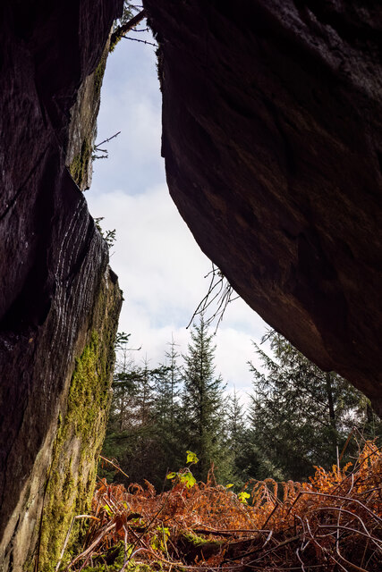
Image: © David Baird Taken: 15 Feb 2023
Having first tried to find this cave 14 years ago, I am very grateful to Mr Dabby McCreadie for showing me its exact location, which is about 200 metres further east from where I had been looking. In the intervening years the surrounding forestry plantation has been clear-felled and replanted, which makes the short walk from the track up to the cave extremely rough and very hard going. The entrance is partly concealed by thick undergrowth. The cave itself is fairly shallow, around 4 metres in length, with the roof angling down to meet the floor at the back and is just large enough for one or two people to lie down. Mr McCreadie told me that his research had suggested that the Murdoch after whom the cave is named was a notorious robber, and it is notable that the line of the Old Edinburgh Road (which was at one time the most direct route from the western part of Galloway to Edinburgh) runs through wild country less than 1½ miles to the south of this spot, so the cave may have been a useful base from which to prey on passing travellers.
Images are licensed for reuse under creativecommons.org/licenses/by-sa/2.0
Image Location


Leaflet Map data © OpenStreetMap
Latitude
55.00634
Longitude
-4.445176