
Approach to Curriehill railway station
Introduction
The photograph on this page of Approach to Curriehill railway station by Ian Dodds as part of the Geograph project.
The Geograph project started in 2005 with the aim of publishing, organising and preserving representative images for every square kilometre of Great Britain, Ireland and the Isle of Man.

There are currently over 7.5m images from over 14,400 individuals and you can help contribute to the project by visiting https://www.geograph.org.uk
Approach to Curriehill railway station
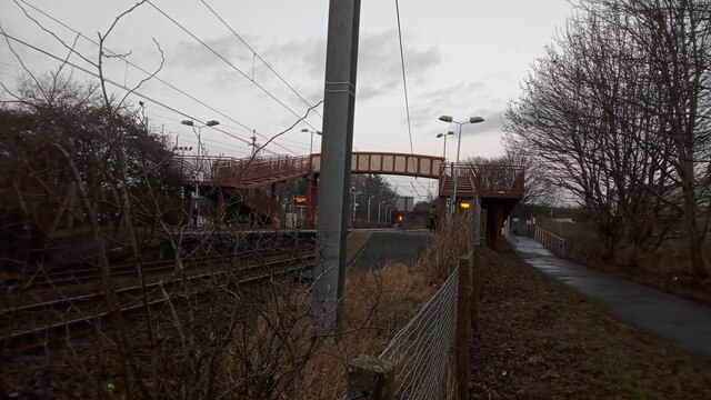
Image: © Ian Dodds Taken: 31 Jan 2023
This station's name has always struck me as quite odd. It of course would be a surprise to find a normal railway station on a hill, unless there was really no alternative. But ignoring that, the name does imply it is on some kind of higher ground, and whilst it is slightly higher than the ground immediately to the North it sits steeply downhill from the village of Currie, which sits at the Western edge of Edinburgh. The name implies it is at Currie's highest point whereas it is in fact at its lowest. Like a number of stations along this line there are no yellow bumpy bits (there to alert guide dogs, the visually impaired and the blind that the platform edge is a certain distance away) between the outer platform and the slabs at its edge. Slateford, a few stops down towards Edinburgh (which is in the direction the camera is pointed), has no yellow bumps either, and regularly announces this on prerecorded speaker announcements, but I have never heard any apologies here. A microcosm of the British railway system's inconsistencies?!
Images are licensed for reuse under creativecommons.org/licenses/by-sa/2.0
Image Location

Latitude
55.90002
Longitude
-3.319213