Ogbourne St George houses [14]
Introduction
The photograph on this page of Ogbourne St George houses [14] by Michael Dibb as part of the Geograph project.
The Geograph project started in 2005 with the aim of publishing, organising and preserving representative images for every square kilometre of Great Britain, Ireland and the Isle of Man.

There are currently over 7.5m images from over 14,400 individuals and you can help contribute to the project by visiting https://www.geograph.org.uk
Ogbourne St George houses [14]
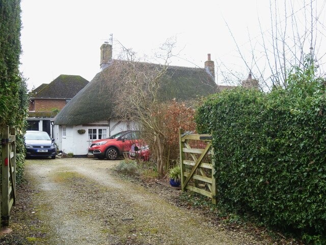
Image: © Michael Dibb Taken: 27 Jan 2023
Bramley Cottage, High Street, was built in the late 17th or early 18th century. The left bay is timber framed, the right bay, in brick, is probably a rebuild. All under a thatch roof. There is a lean-to extension on the left, over which the thatch has been swept down. Listed, grade II, with details at: https://historicengland.org.uk/listing/the-list/list-entry/1365584 Ogbourne St George is a village in the valley of the River Og in Wiltshire. It is sited just off the Roman Road from Cirencester to Winchester, about 7 miles south of Swindon and some 3¼ miles north of Marlborough. The name derives from the Saxon 'Oceburnan' or 'Oc[c]a's stream'. There is a great deal of evidence of prehistoric, Roman and medieval activity including Neolithic flint tools, Iron Age coins, Romano-British coins and pottery and medieval pottery fragments. Ogbourne St George today is a commuter village.
Images are licensed for reuse under creativecommons.org/licenses/by-sa/2.0
Image Location
Latitude
51.466242
Longitude
-1.710385