Old Boundary Marker between Swincliffe and Hampsthwaite
Introduction
The photograph on this page of Old Boundary Marker between Swincliffe and Hampsthwaite by M Towler as part of the Geograph project.
The Geograph project started in 2005 with the aim of publishing, organising and preserving representative images for every square kilometre of Great Britain, Ireland and the Isle of Man.

There are currently over 7.5m images from over 14,400 individuals and you can help contribute to the project by visiting https://www.geograph.org.uk
Old Boundary Marker between Swincliffe and Hampsthwaite
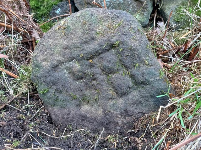
Image: © M Towler Taken: 3 Feb 2023
Parish Boundary Marker against a drystone wall on the southeast side of a minor road between Swincliffe and Hampsthwaite. The inscription may read F H as the stone stands on the boundary of Felliscliffe and Hampsthwaite parishes. Felliscliffe was a township in Hampsthwaite parish until 1866, but a boundary stone is marked on the 1853 Ordnance Survey 6 inch map. Milestone Society National ID: YW_FELHAM01pb
Images are licensed for reuse under creativecommons.org/licenses/by-sa/2.0
Image Location


Leaflet Map data © OpenStreetMap
Latitude
54.019377
Longitude
-1.617796