Shepherds Station
Introduction
The photograph on this page of Shepherds Station by John Thorn as part of the Geograph project.
The Geograph project started in 2005 with the aim of publishing, organising and preserving representative images for every square kilometre of Great Britain, Ireland and the Isle of Man.

There are currently over 7.5m images from over 14,400 individuals and you can help contribute to the project by visiting https://www.geograph.org.uk
Shepherds Station
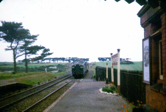
Image: © John Thorn Taken: Unknown
This railway linked Truro to Newquay, 'Shepherds' is a nearby farm. The line closed a few weeks after this picture was taken.
Images are licensed for reuse under creativecommons.org/licenses/by-sa/2.0
Image Location


Leaflet Map data © OpenStreetMap
Latitude
50.348987
Longitude
-5.068425