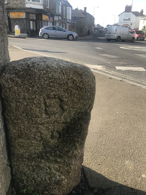
Old Guidestone by Fore Street (East face)
Introduction
The photograph on this page of Old Guidestone by Fore Street (East face) by Paul Barnett as part of the Geograph project.
The Geograph project started in 2005 with the aim of publishing, organising and preserving representative images for every square kilometre of Great Britain, Ireland and the Isle of Man.
There are currently over 7.5m images from over 14,400 individuals and you can help contribute to the project by visiting https://www.geograph.org.uk

Image: © Paul Barnett Taken: 13 Feb 2023
The Guide Stone is located on the South of the road. Parish of Carn Brea (Kerrier District). Carved stone post, erected in the 19th Century. Some believe this is a boundary marker between Basset / TB Vyvyan land, but there are clearly arrows and this face does not just have B. The word POOL is not clear and there looks to be CAMBORNE at the bottom. This possibly refers to the western extent of Basset land. Another photograph can be found here: https://www.geograph.org.uk/photo/7405364 Inscription reads:- TBV / —> / POOL / <— : : TBV / <— / (POOL) / -> Milestone Society National ID: CW_POO01

