Benchmark, Bridge House, Low Gelt Bridge
Introduction
The photograph on this page of Benchmark, Bridge House, Low Gelt Bridge by Adrian Taylor as part of the Geograph project.
The Geograph project started in 2005 with the aim of publishing, organising and preserving representative images for every square kilometre of Great Britain, Ireland and the Isle of Man.

There are currently over 7.5m images from over 14,400 individuals and you can help contribute to the project by visiting https://www.geograph.org.uk
Benchmark, Bridge House, Low Gelt Bridge
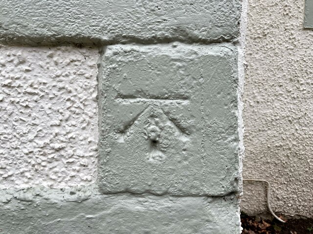
Image: © Adrian Taylor Taken: 12 Feb 2023
Detail of the Ordnance Survey cut benchmark on a painted stone quoin on the northwest corner of Bridge House. The benchmark marks a height of 57.5762m above mean sea level (Ordnance Datum Newlyn) last verified in 1972 (location photograph Image).
Images are licensed for reuse under creativecommons.org/licenses/by-sa/2.0
Image Location
Latitude
54.924633
Longitude
-2.751073