Gates to the Lantern Drive, Gellyburn
Introduction
The photograph on this page of Gates to the Lantern Drive, Gellyburn by Paul McLennan as part of the Geograph project.
The Geograph project started in 2005 with the aim of publishing, organising and preserving representative images for every square kilometre of Great Britain, Ireland and the Isle of Man.

There are currently over 7.5m images from over 14,400 individuals and you can help contribute to the project by visiting https://www.geograph.org.uk
Gates to the Lantern Drive, Gellyburn
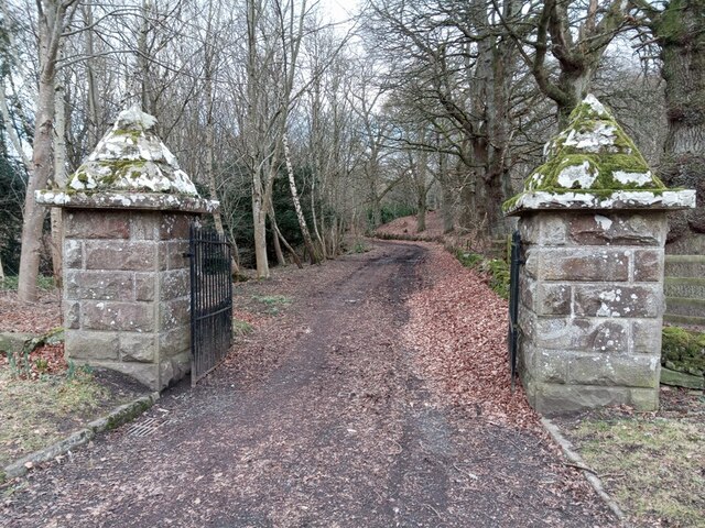
Image: © Paul McLennan Taken: 12 Feb 2023
Conical pillars like these are a feature of Murthly Estate's designed landscape. In this case they lead from the old Dunkeld - Perth Turnpike (now the B9099) onto the Lantern Drive and up to Douglasfield or Home Farm. Lantern Lodge, built about 1858, and Category 'B' listed, stood about one kilometre further along until it was demolished in the early 1970s.
Images are licensed for reuse under creativecommons.org/licenses/by-sa/2.0
Image Location
Latitude
56.535151
Longitude
-3.474392