Farina Mill, Gellyburn
Introduction
The photograph on this page of Farina Mill, Gellyburn by Paul McLennan as part of the Geograph project.
The Geograph project started in 2005 with the aim of publishing, organising and preserving representative images for every square kilometre of Great Britain, Ireland and the Isle of Man.

There are currently over 7.5m images from over 14,400 individuals and you can help contribute to the project by visiting https://www.geograph.org.uk
Farina Mill, Gellyburn
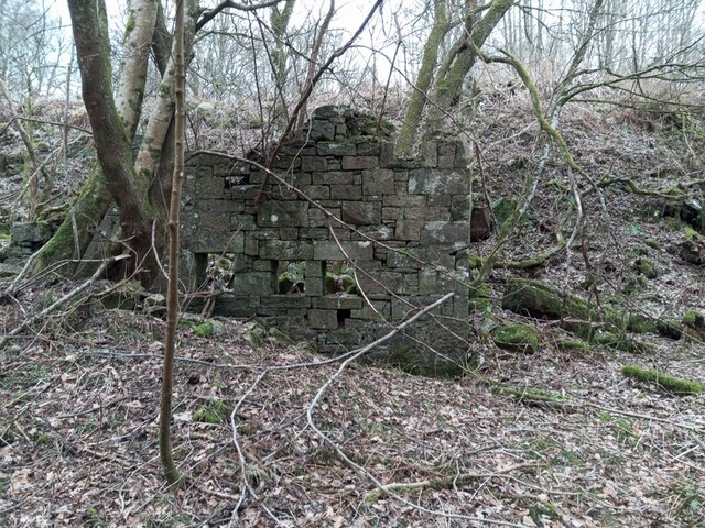
Image: © Paul McLennan Taken: 12 Feb 2023
All that remains of the Farina Mill, and Gellyburn's industrial heritage, is this wall and several sections of the sluices. The mill was built in 1858 to process potatoes (an abundant local crop) into flour, which was then exported via the goods yard at Murthly Station 2km distant.
Images are licensed for reuse under creativecommons.org/licenses/by-sa/2.0
Image Location
Latitude
56.536863
Longitude
-3.473971