Druids Park Stone Circle
Introduction
The photograph on this page of Druids Park Stone Circle by Paul McLennan as part of the Geograph project.
The Geograph project started in 2005 with the aim of publishing, organising and preserving representative images for every square kilometre of Great Britain, Ireland and the Isle of Man.

There are currently over 7.5m images from over 14,400 individuals and you can help contribute to the project by visiting https://www.geograph.org.uk
Druids Park Stone Circle
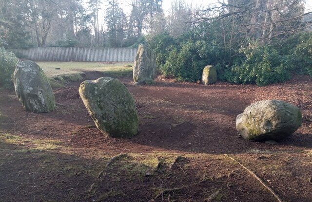
Image: © Paul McLennan Taken: 7 Feb 2023
An incomplete circle of five stones (there is room for seven or eight). First mapped as five by James Stobie in 1783. So subsequent developments as a) Perthshire's Asylum for Pauper Lunatics (1864), and b) an upmarket housing estate (post 1986) are not to blame. The earth rampart and rhododendron are Victorian additions.
Images are licensed for reuse under creativecommons.org/licenses/by-sa/2.0
Image Location
Latitude
56.530012
Longitude
-3.460698