Old circular AA sign on Ingleby Road, Great Broughton
Introduction
The photograph on this page of Old circular AA sign on Ingleby Road, Great Broughton by M Rayner as part of the Geograph project.
The Geograph project started in 2005 with the aim of publishing, organising and preserving representative images for every square kilometre of Great Britain, Ireland and the Isle of Man.

There are currently over 7.5m images from over 14,400 individuals and you can help contribute to the project by visiting https://www.geograph.org.uk
Old circular AA sign on Ingleby Road, Great Broughton
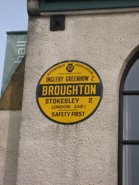
Image: © M Rayner Taken: 6 May 2016
Old AA Sign located on the south facing wall of the village hall on the northeast side of a crossroads of Ingleby Road and the B1257 High Street, Great Broughton, 2 miles southeast of Stokesley. Great and Little Broughton parish. This is the circular, village name on black band, no Motor Union symbol or name type, dating from 1923 and showing distances Ingleby Greenhow 2 Stokesley 2 London 248½. There were five series of AA signs, mostly dating from 1923 and made by Francis & Co / Franco in Deptford, London. The village name and distance to London or Dublin were normally displayed. See also https://www.geograph.org.uk/photo/6076740 , https://www.flickr.com/photos/11065676@N00/5870151826 and https://www.geograph.org.uk/photo/1640515. Milestone Society National ID: YO-GTBROU
Images are licensed for reuse under creativecommons.org/licenses/by-sa/2.0
Image Location
Latitude
54.449517
Longitude
-1.157479