
20-25 Ardmillan Terrace and 60-64 Angle Park Terrace, Edinburgh
Introduction
The photograph on this page of 20-25 Ardmillan Terrace and 60-64 Angle Park Terrace, Edinburgh by Claire Pegrum as part of the Geograph project.
The Geograph project started in 2005 with the aim of publishing, organising and preserving representative images for every square kilometre of Great Britain, Ireland and the Isle of Man.

There are currently over 7.5m images from over 14,400 individuals and you can help contribute to the project by visiting https://www.geograph.org.uk
20-25 Ardmillan Terrace and 60-64 Angle Park Terrace, Edinburgh
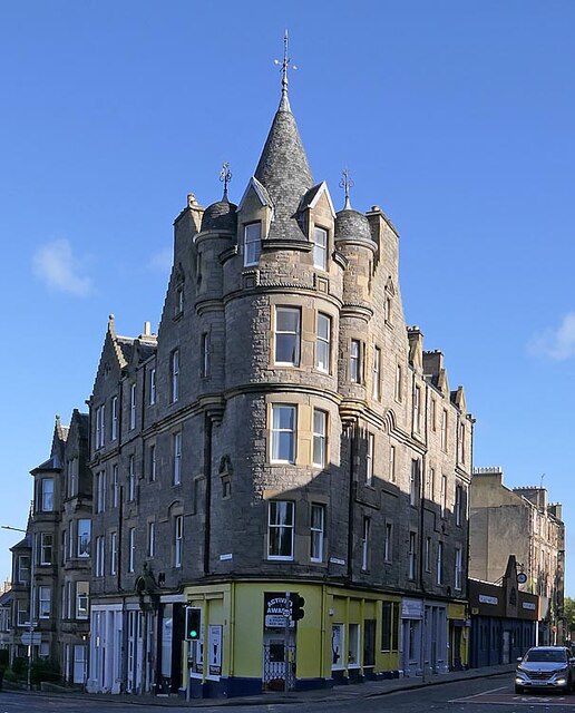
Image: © Claire Pegrum Taken: 2 Oct 2022
The building is Category B listed and its listing describes it as "John C Hay, 1887. Baronial tenement with principal block turning acute corner in 5-stage tower with shops at ground, attic at intervals and closing to NW in 3-storey residential block on falling ground. Squared and snecked sandstone with ashlar dressings, stop-chamfered arrises, tabbed margins. Principal gables crowstepped. Cornice above 2- and 3-bay original shopfronts. 3rd Floor above decorative corbel course". The spire has previously been used as an intersected station by the Ordnance Survey.
Images are licensed for reuse under creativecommons.org/licenses/by-sa/2.0
Image Location

Latitude
55.937434
Longitude
-3.226351