Burbage houses [22]
Introduction
The photograph on this page of Burbage houses [22] by Michael Dibb as part of the Geograph project.
The Geograph project started in 2005 with the aim of publishing, organising and preserving representative images for every square kilometre of Great Britain, Ireland and the Isle of Man.

There are currently over 7.5m images from over 14,400 individuals and you can help contribute to the project by visiting https://www.geograph.org.uk
Burbage houses [22]
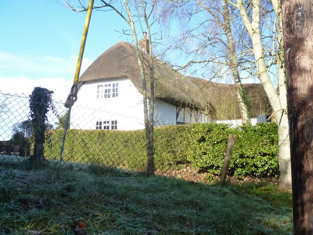
Image: © Michael Dibb Taken: 23 Jan 2023
Hallams, number 166 High Street, was built in the late 16th or early 17th century. Timber framed with brick nogging under a thatch roof. Later, a crosswing on the right and a single bay on the left were added in brick. Listed, grade II, with details at: https://historicengland.org.uk/listing/the-list/list-entry/1035924 Burbage is a village in the Vale of Pewsey, Wiltshire, it lies about 5½ miles southeast of Marlborough and some 15½ miles west of Newbury. The narrow village High Street was the main north to south road from Marlborough to Andover (A346) until a bypass was built to the west in 1991. Settlement can be traced back to the Neolithic period, and Bronze Age artefacts have been found. Burbage is now essentially a commuter village.
Images are licensed for reuse under creativecommons.org/licenses/by-sa/2.0
Image Location
Latitude
51.349958
Longitude
-1.671272