Old Milestone, A595, Carlisle
Introduction
The photograph on this page of Old Milestone, A595, Carlisle by Karen Kelso as part of the Geograph project.
The Geograph project started in 2005 with the aim of publishing, organising and preserving representative images for every square kilometre of Great Britain, Ireland and the Isle of Man.

There are currently over 7.5m images from over 14,400 individuals and you can help contribute to the project by visiting https://www.geograph.org.uk
Old Milestone, A595, Carlisle
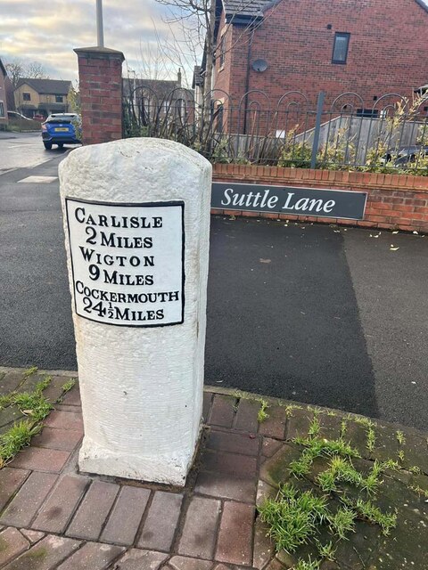
Image: © Karen Kelso Taken: 29 Jan 2023
Modern resiting of milestone at new development in Suttle Lane. Metal plate attached to stone post by the A595, in parish of CARLISLE (CARLISLE District), Wigton Road, Morton School, 100m North of junction with Glaramara Drive, near Suttle House, in hedge behind wide footpath/cycleway; just South of bus-shelter, on North side of road. Carlisle red stone and curved plate, erected by the Cockermouth & Carlisle turnpike trust in the 19th century. Image from 2006 is Image Inscription reads: CARLISLE / 2 MILES / WIGTON / 9 MILES / COCKERMOUTH / 4½ MILES Grade II Listed. List Entry Number: 1197153 https://historicengland.org.uk/listing/the-list/list-entry/1197153 Milestone Society National ID: CU_CLCM02
Images are licensed for reuse under creativecommons.org/licenses/by-sa/2.0
Image Location
Latitude
54.879074
Longitude
-2.972372