Former inn?
Introduction
The photograph on this page of Former inn? by John M as part of the Geograph project.
The Geograph project started in 2005 with the aim of publishing, organising and preserving representative images for every square kilometre of Great Britain, Ireland and the Isle of Man.

There are currently over 7.5m images from over 14,400 individuals and you can help contribute to the project by visiting https://www.geograph.org.uk
Former inn?
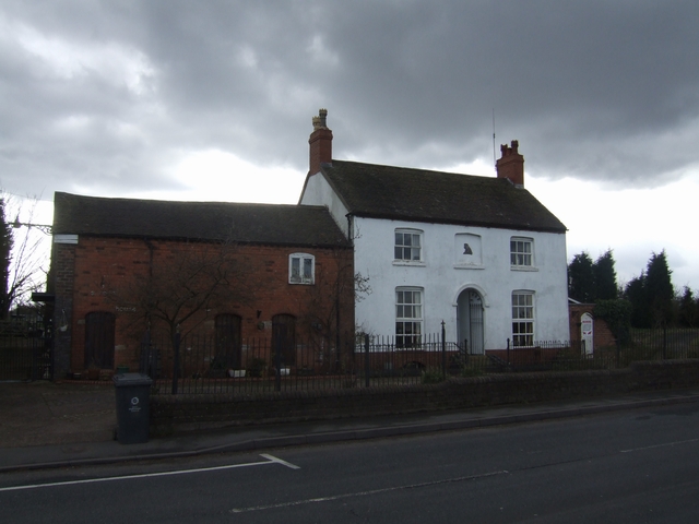
Image: © John M Taken: 24 Mar 2008
I haven't been able to name this but assume this was once an inn on the edge of the village and next to the coal mines and clay pit.
Images are licensed for reuse under creativecommons.org/licenses/by-sa/2.0
Image Location
Latitude
52.66242
Longitude
-2.044461