The Red House, Croxley Green
Introduction
The photograph on this page of The Red House, Croxley Green by Stephen McKay as part of the Geograph project.
The Geograph project started in 2005 with the aim of publishing, organising and preserving representative images for every square kilometre of Great Britain, Ireland and the Isle of Man.

There are currently over 7.5m images from over 14,400 individuals and you can help contribute to the project by visiting https://www.geograph.org.uk
The Red House, Croxley Green
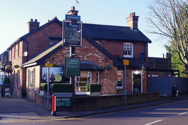
Image: © Stephen McKay Taken: 20 Jan 2023
Although not unique, the Red House is an unusual name for a pub and it is believed that it acquired the name in about 1870. At that time this would have been a rural area but that changed in the 1920s when the Metropolitan Line station arrived next door. Today the pub is a Greene King house with the emphasis on food.
Images are licensed for reuse under creativecommons.org/licenses/by-sa/2.0
Image Location
Latitude
51.647063
Longitude
-0.442628