Information board at Wolstanton Retail Park (detail)
Introduction
The photograph on this page of Information board at Wolstanton Retail Park (detail) by Jonathan Hutchins as part of the Geograph project.
The Geograph project started in 2005 with the aim of publishing, organising and preserving representative images for every square kilometre of Great Britain, Ireland and the Isle of Man.

There are currently over 7.5m images from over 14,400 individuals and you can help contribute to the project by visiting https://www.geograph.org.uk
Information board at Wolstanton Retail Park (detail)
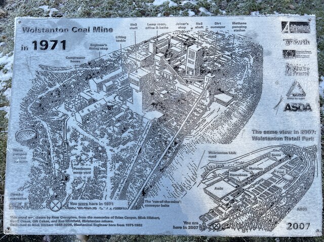
Image: © Jonathan Hutchins Taken: 21 Jan 2023
Shows a detailed reconstruction of the mining complex, now entirely gone and replaced by a retail park. The board is shown in context at https://www.geograph.org.uk/photo/7387895
Images are licensed for reuse under creativecommons.org/licenses/by-sa/2.0
Image Location
Latitude
53.026838
Longitude
-2.208485