Triangulation pillar and radar station, Alans Hill, Aberdeenshire
Introduction
The photograph on this page of Triangulation pillar and radar station, Alans Hill, Aberdeenshire by Claire Pegrum as part of the Geograph project.
The Geograph project started in 2005 with the aim of publishing, organising and preserving representative images for every square kilometre of Great Britain, Ireland and the Isle of Man.

There are currently over 7.5m images from over 14,400 individuals and you can help contribute to the project by visiting https://www.geograph.org.uk
Triangulation pillar and radar station, Alans Hill, Aberdeenshire
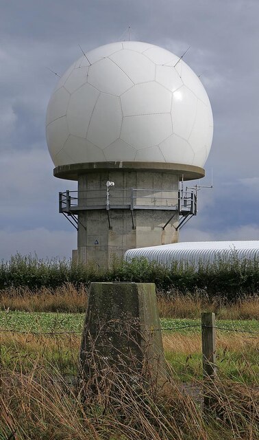
Image: © Claire Pegrum Taken: 7 Sep 2022
The radar station is operated by NATS (National Air Traffic Services). The radome (the "golf ball" which protects the radar antenna) was replaced in 2018: https://www.nats.aero/features/replacing-allanshill-radome/ .
Images are licensed for reuse under creativecommons.org/licenses/by-sa/2.0
Image Location
Latitude
57.642744
Longitude
-2.166171