Plimsoll Avenue
Introduction
The photograph on this page of Plimsoll Avenue by John Baker as part of the Geograph project.
The Geograph project started in 2005 with the aim of publishing, organising and preserving representative images for every square kilometre of Great Britain, Ireland and the Isle of Man.

There are currently over 7.5m images from over 14,400 individuals and you can help contribute to the project by visiting https://www.geograph.org.uk
Plimsoll Avenue
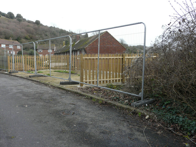
Image: © John Baker Taken: 1 Jan 2023
Planning permission has been granted, with conditions, by Folkestone and Hythe District Council under application number 22/1531 for the "erection of a detached two-storey dwelling in the side garden to the west of 1, Plimsoll Avenue". The end wall of 1, Plimsoll Avenue is visible beyond the site, which is in Montgomery Way. Taken during a photographic outing on New Year's Day afternoon.
Images are licensed for reuse under creativecommons.org/licenses/by-sa/2.0
Image Location
Latitude
51.096546
Longitude
1.184502