Oakford : Stuckeridge Bridge
Introduction
The photograph on this page of Oakford : Stuckeridge Bridge by Lewis Clarke as part of the Geograph project.
The Geograph project started in 2005 with the aim of publishing, organising and preserving representative images for every square kilometre of Great Britain, Ireland and the Isle of Man.

There are currently over 7.5m images from over 14,400 individuals and you can help contribute to the project by visiting https://www.geograph.org.uk
Oakford : Stuckeridge Bridge
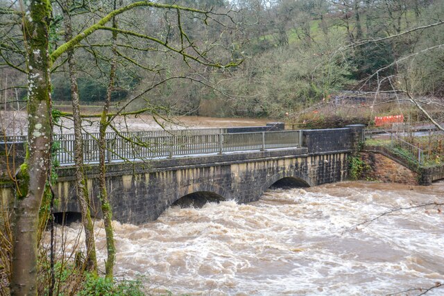
Image: © Lewis Clarke Taken: 12 Jan 2023
Road bridge over the River Exe. Probably early C19, C20 parapets. Dressed stone brought to course, steel parapet balustrades. 3-span bridge with segmental arches and cutwaters. Road and bridge not shown on 1809 OS map, probably a turnpike road and bridge.
Images are licensed for reuse under creativecommons.org/licenses/by-sa/2.0
Image Location


Leaflet Map data © OpenStreetMap
Latitude
50.983983
Longitude
-3.520874