Raised Beach and head deposits
Introduction
The photograph on this page of Raised Beach and head deposits by Hugh Venables as part of the Geograph project.
The Geograph project started in 2005 with the aim of publishing, organising and preserving representative images for every square kilometre of Great Britain, Ireland and the Isle of Man.

There are currently over 7.5m images from over 14,400 individuals and you can help contribute to the project by visiting https://www.geograph.org.uk
Raised Beach and head deposits
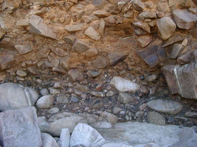
Image: © Hugh Venables Taken: 15 Aug 2002
Rounded stones in eroded cliff were beach material 120000 years ago when the sea level was a bit higher due to a warmer climate. The climate then worsened as the world went into the most recent glacial period (100000 to 15000 years ago) and the area was tundra - the angular rocks above were split by ice and sea level was over 40 metres below current levels
Images are licensed for reuse under creativecommons.org/licenses/by-sa/2.0
Image Location


Leaflet Map data © OpenStreetMap
Latitude
50.162755
Longitude
-5.658674