Hayle : Angarrack - Angarrack Viaduct
Introduction
The photograph on this page of Hayle : Angarrack - Angarrack Viaduct by Lewis Clarke as part of the Geograph project.
The Geograph project started in 2005 with the aim of publishing, organising and preserving representative images for every square kilometre of Great Britain, Ireland and the Isle of Man.

There are currently over 7.5m images from over 14,400 individuals and you can help contribute to the project by visiting https://www.geograph.org.uk
Hayle : Angarrack - Angarrack Viaduct
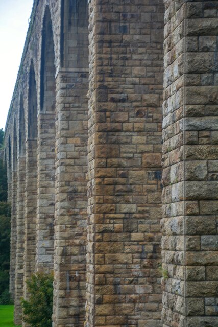
Image: © Lewis Clarke Taken: 1 Oct 2022
The eleven-arch granite-built viaduct carries the Cornish Main Line railway across the steep-sided valley of the Angarrack River, a tributary of the River Hayle, between the present day stations of Camborne and Hayle. The village extends up the valley and under the viaduct.
Images are licensed for reuse under creativecommons.org/licenses/by-sa/2.0
Image Location
Latitude
50.19338
Longitude
-5.3848