Yarm Railway Viaduct over the R Tees
Introduction
The photograph on this page of Yarm Railway Viaduct over the R Tees by Colin Park as part of the Geograph project.
The Geograph project started in 2005 with the aim of publishing, organising and preserving representative images for every square kilometre of Great Britain, Ireland and the Isle of Man.

There are currently over 7.5m images from over 14,400 individuals and you can help contribute to the project by visiting https://www.geograph.org.uk
Yarm Railway Viaduct over the R Tees
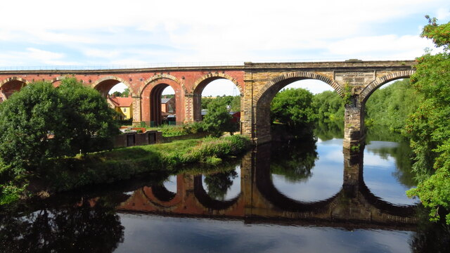
Image: © Colin Park Taken: 9 Aug 2022
The viaduct extends for over 2,280 feet in a north/south direction over the town of Yarm and across the River Tees. It consists of 43 arches; 41 of them are 40 feet span and are constructed of 7.5 million red bricks. The other two arches are constructed from stone and are 67 feet across with one pier standing in the river. The two spans across the river are composed of 139,000 cubic feet of stone and are skewed across the river by 20 degrees. On the downstream side of the viaduct (eastern side) is a large plaque set into the stone section of where the bridge spans the river. This commemorates the engineers and contractors on the project.
Images are licensed for reuse under creativecommons.org/licenses/by-sa/2.0
Image Location
Latitude
54.512216
Longitude
-1.357124