Orcheston houses [9]
Introduction
The photograph on this page of Orcheston houses [9] by Michael Dibb as part of the Geograph project.
The Geograph project started in 2005 with the aim of publishing, organising and preserving representative images for every square kilometre of Great Britain, Ireland and the Isle of Man.

There are currently over 7.5m images from over 14,400 individuals and you can help contribute to the project by visiting https://www.geograph.org.uk
Orcheston houses [9]
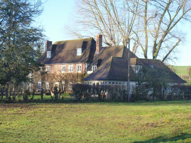
Image: © Michael Dibb Taken: 2 Jan 2023
Quainton is a detached house, dated 1663. There have been alterations in the 18th century and there are two early 19th century extensions. Constructed of brick with stone quoins, the 19th century addition is of cob, all under a concrete tile roof. Listed, grade II, with details at: https://historicengland.org.uk/listing/the-list/list-entry/1181862 The small village of Orcheston lies on Salisbury Plain about a mile northwest of Shrewton and some 6¼ miles west of Durrington. Salisbury plain has been inhabited since prehistoric times, and Orcheston is recorded in the 1086 Domesday Book. The source of the River Till is nearby. The village has two 13th century churches.
Images are licensed for reuse under creativecommons.org/licenses/by-sa/2.0
Image Location


Leaflet Map data © OpenStreetMap
Latitude
51.207941
Longitude
-1.917482