Boundary marker by the Thames cycle path, Kingston upon Thames
Introduction
The photograph on this page of Boundary marker by the Thames cycle path, Kingston upon Thames by John S Turner as part of the Geograph project.
The Geograph project started in 2005 with the aim of publishing, organising and preserving representative images for every square kilometre of Great Britain, Ireland and the Isle of Man.

There are currently over 7.5m images from over 14,400 individuals and you can help contribute to the project by visiting https://www.geograph.org.uk
Boundary marker by the Thames cycle path, Kingston upon Thames
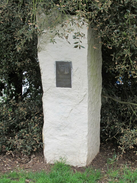
Image: © John S Turner Taken: 9 May 2012
Municipal Boundary Marker on the west side of the cycle track, east of the River Thames towpath, and two metres east of SY_KIN01pb Image On the boundary between the boroughs of Kingston upon Thames and Richmond upon Thames. Inscription reads: Royal (crown emblem) Kingston (three salmon emblem) This stone marks the boundary of The Royal Borough of Kingston upon Thames, and the London Borough of Richmond upon Thames. It also commemorates a new public park at "Royal Park Gate", on the site of a former British Aerospace Factory. Opened by David Jacobs, CBE, Representative Deputy Lieutenant and Freeman of the Royal Borough of Kingston upon Thames. 1998 For a wider view see Image Milestone Society National ID: SY_KIN02pb
Images are licensed for reuse under creativecommons.org/licenses/by-sa/2.0
Image Location
Latitude
51.428691
Longitude
-0.314082