Balquharrage Bridge
Introduction
The photograph on this page of Balquharrage Bridge by Richard Sutcliffe as part of the Geograph project.
The Geograph project started in 2005 with the aim of publishing, organising and preserving representative images for every square kilometre of Great Britain, Ireland and the Isle of Man.

There are currently over 7.5m images from over 14,400 individuals and you can help contribute to the project by visiting https://www.geograph.org.uk
Balquharrage Bridge
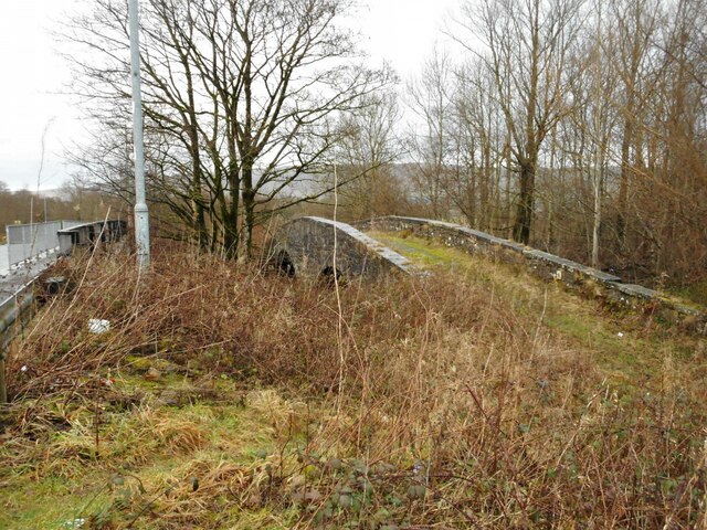
Image: © Richard Sutcliffe Taken: 7 Jan 2023
This 18th or early 19th century bridge used to carry Campsie Road over the River Kelvin. Long bypassed by a modern and wider steel girder bridge (on the left), the bridge is no longer in use, even for pedestrians, as a wall prevents access at the southern end. The bridge is Category C listed http://portal.historicenvironment.scot/designation/LB36659, although Historic Environment Scotland have currently got the entry for it located against the wrong bridge!
Images are licensed for reuse under creativecommons.org/licenses/by-sa/2.0
Image Location
Latitude
55.943076
Longitude
-4.163586