Old Boundary Stone, Coningsby Street, Hereford
Introduction
The photograph on this page of Old Boundary Stone, Coningsby Street, Hereford by Mr Red as part of the Geograph project.
The Geograph project started in 2005 with the aim of publishing, organising and preserving representative images for every square kilometre of Great Britain, Ireland and the Isle of Man.

There are currently over 7.5m images from over 14,400 individuals and you can help contribute to the project by visiting https://www.geograph.org.uk
Old Boundary Stone, Coningsby Street, Hereford
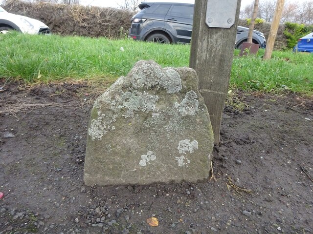
Image: © Mr Red Taken: 6 Jan 2023
On the Northern footpath of the road. The central one of three, probably marking the various iterations of parish divisions in the city. In 1903 they were marking the boundary between the parishes of St Peter and St John the Baptist. The location of the stones can be seen on the RHS of Image The other two on https://www.geograph.org.uk/photo/7376803 & https://www.geograph.org.uk/photo/7376802. A collection of similar images can be seen at https://www.geograph.org.uk/article/Boundary-Stones-of-the-City-of-Hereford Milestone Society National ID: HF_HERE06pb
Images are licensed for reuse under creativecommons.org/licenses/by-sa/2.0
Image Location
Latitude
52.059159
Longitude
-2.713604