View from Bridgewater Canal Towpath at Keckwick
Introduction
The photograph on this page of View from Bridgewater Canal Towpath at Keckwick by Sue Adair as part of the Geograph project.
The Geograph project started in 2005 with the aim of publishing, organising and preserving representative images for every square kilometre of Great Britain, Ireland and the Isle of Man.

There are currently over 7.5m images from over 14,400 individuals and you can help contribute to the project by visiting https://www.geograph.org.uk
View from Bridgewater Canal Towpath at Keckwick
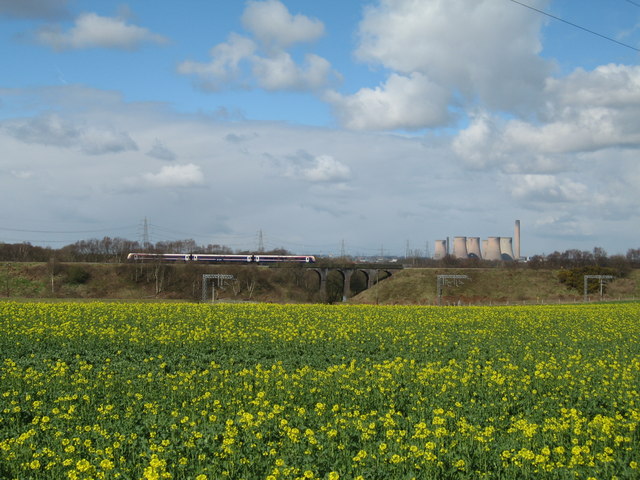
Image: © Sue Adair Taken: 24 Mar 2008
View over the rape seed fields to Fiddler's Ferry powerstation from the towpath of the Bridgewater Canal at Keckwick. On the railway embankment, visible in the foreground, is the local line train while out of sight in the valley below run the Keckwick brook and the West Coast Main Line, the electric power lines of which are just visible.
Images are licensed for reuse under creativecommons.org/licenses/by-sa/2.0
Image Location


Leaflet Map data © OpenStreetMap
Latitude
53.337605
Longitude
-2.65474