Fire Destroyed Building, Annison Street, Bradford
Introduction
The photograph on this page of Fire Destroyed Building, Annison Street, Bradford by Stephen Armstrong as part of the Geograph project.
The Geograph project started in 2005 with the aim of publishing, organising and preserving representative images for every square kilometre of Great Britain, Ireland and the Isle of Man.

There are currently over 7.5m images from over 14,400 individuals and you can help contribute to the project by visiting https://www.geograph.org.uk
Fire Destroyed Building, Annison Street, Bradford
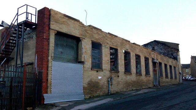
Image: © Stephen Armstrong Taken: 2 Jan 2023
A former warehouse, suspected of being used as a cannabis factory, destroyed by fire on 3rd January 2021. The front wall of the upper floor was left standing after the fire, but was quickly demolished for safety reasons. The building can be seen intact in my image from 2012 Image
Images are licensed for reuse under creativecommons.org/licenses/by-sa/2.0
Image Location
Latitude
53.794737
Longitude
-1.739464