Tregantle Fort near Antony
Introduction
The photograph on this page of Tregantle Fort near Antony by Colin Park as part of the Geograph project.
The Geograph project started in 2005 with the aim of publishing, organising and preserving representative images for every square kilometre of Great Britain, Ireland and the Isle of Man.

There are currently over 7.5m images from over 14,400 individuals and you can help contribute to the project by visiting https://www.geograph.org.uk
Tregantle Fort near Antony
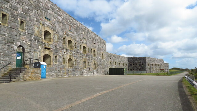
Image: © Colin Park Taken: 7 Apr 2022
Tregantle Fort is one of several forts surrounding Plymouth that were built as a result of a decision in Lord Palmerston's premiership to deter the French from attacking naval bases on the Channel coast. The fort was originally designed by Captain William Crossman, with later modifications by Captain (later Maj General) Edmund Frederick Du Cane. Construction commenced in 1859 and was completed in 1865. When originally designed it had provision for 35 large guns. By 1893 the guns consisted of five RBL 7 inch Armstrong guns and nineteen RML 64-pounders, together with a number of 32 Pounder Smooth Bore Breech Loading guns. Early in the 1900s it became an infantry battalion headquarters with 14 officers and 423 other ranks, and from 1903 was used for rifle training. Tregantle is infamous within the armed forces because many of the rifle ranges located there slope steeply down towards the sea. These ranges are still in use, primarily by personnel located at HMS Raleigh. Tregantle was vacated after World War I until 1938, when it was used as the Territorial Army Passive Air Defence School. During World War II it was used first as the Army Gas School and from 1942 as US Army accommodation. (source Wikipedia)
Images are licensed for reuse under creativecommons.org/licenses/by-sa/2.0
Image Location


Leaflet Map data © OpenStreetMap
Latitude
50.35663
Longitude
-4.269601