Overflow, Bottoms Reservoir
Introduction
The photograph on this page of Overflow, Bottoms Reservoir by Stephen Craven as part of the Geograph project.
The Geograph project started in 2005 with the aim of publishing, organising and preserving representative images for every square kilometre of Great Britain, Ireland and the Isle of Man.

There are currently over 7.5m images from over 14,400 individuals and you can help contribute to the project by visiting https://www.geograph.org.uk
Overflow, Bottoms Reservoir
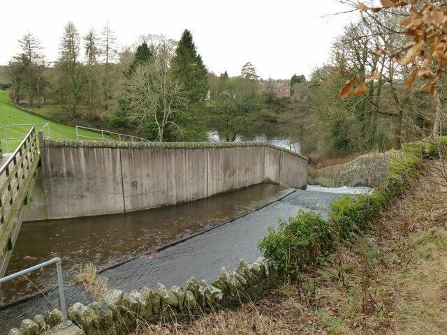
Image: © Stephen Craven Taken: 29 Dec 2022
The country park's website explains that the reservoir was constructed in 1850 to supply water to factories in nearby Langley Village. The 1897 OS map tells a slightly different story as it is labelled as belonging to Macclesfield Corporation Water Works, suggesting that it was built mainly for public supply. There is a slightly unusual arrangement with this and the adjacent Bottoms Reservoir discharging their overflows into a combined, small reservoir or stilling basin.
Images are licensed for reuse under creativecommons.org/licenses/by-sa/2.0
Image Location
Latitude
53.242115
Longitude
-2.082973