Kirkandrews House
Introduction
The photograph on this page of Kirkandrews House by Anne Burgess as part of the Geograph project.
The Geograph project started in 2005 with the aim of publishing, organising and preserving representative images for every square kilometre of Great Britain, Ireland and the Isle of Man.

There are currently over 7.5m images from over 14,400 individuals and you can help contribute to the project by visiting https://www.geograph.org.uk
Kirkandrews House
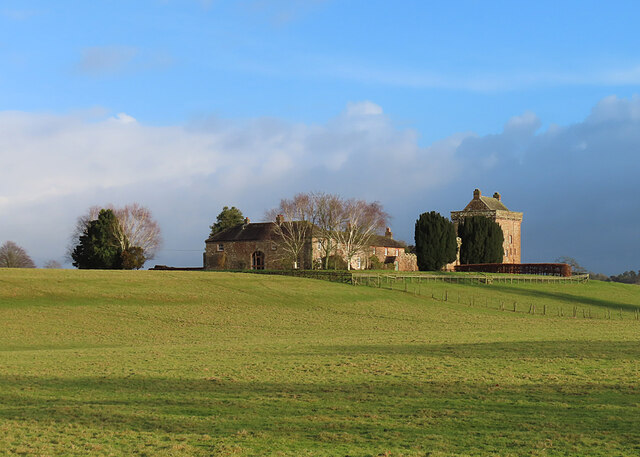
Image: © Anne Burgess Taken: 29 Dec 2022
The house, which is Grade II Listed, was built in about 1827, presumably as a more comfortable residence than the old peel tower alongside it. See https://historicengland.org.uk/listing/the-list/list-entry/1205417 for details.
Images are licensed for reuse under creativecommons.org/licenses/by-sa/2.0
Image Location


Leaflet Map data © OpenStreetMap
Latitude
55.037745
Longitude
-2.958359