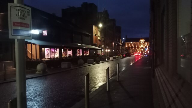
Springfield Street, Warrington
Introduction
The photograph on this page of Springfield Street, Warrington by Ian Dodds as part of the Geograph project.
The Geograph project started in 2005 with the aim of publishing, organising and preserving representative images for every square kilometre of Great Britain, Ireland and the Isle of Man.
There are currently over 7.5m images from over 14,400 individuals and you can help contribute to the project by visiting https://www.geograph.org.uk

Image: © Ian Dodds Taken: 28 Dec 2022
If you ever have half an hour between train connections at Warrington Bank Quay, it is well worth having a quick wander through the grid of streets opposite the main entrance to the station. This area of Warrington was obviously once the important bit; 'Inland Revenue' and 'County Court' are inscribed above the doorways of similar grand red-brick buildings nearby. The area now gets called the 'Cultural Quarter' - by the local council and other marketing departments at least. The big building on the left, beyond the Chinese restaurant, was once the main post office and is now home to a 'hotel', which seems to be more of a short-term self-catering apartment block, as every room comes with its own kitchenette. Deuce Hotels, who have recently taken over the place, describe it as having 'dark glamour and regal sophistication throughout', which is pretty good enticing blurb I reckon! The building at the end of the street (which is lit up more than normal due to it being Christmas) is now partly occupied by a restaurant. It was built as a technical school and then had something to do with finance. Both buildings were built around 1900 and are Grade II listed.

