Plaque at the Broad Stone
Introduction
The photograph on this page of Plaque at the Broad Stone by Anne Burgess as part of the Geograph project.
The Geograph project started in 2005 with the aim of publishing, organising and preserving representative images for every square kilometre of Great Britain, Ireland and the Isle of Man.

There are currently over 7.5m images from over 14,400 individuals and you can help contribute to the project by visiting https://www.geograph.org.uk
Plaque at the Broad Stone
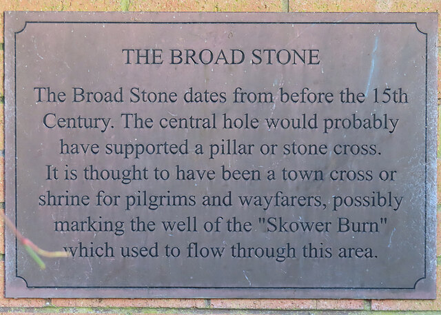
Image: © Anne Burgess Taken: 25 Dec 2022
The plaque is built into the dyke behind Image
Images are licensed for reuse under creativecommons.org/licenses/by-sa/2.0
Image Location
Latitude
57.474965
Longitude
-4.214523