Bellview, Bell Green, no Bell
Introduction
The photograph on this page of Bellview, Bell Green, no Bell by A J Paxton as part of the Geograph project.
The Geograph project started in 2005 with the aim of publishing, organising and preserving representative images for every square kilometre of Great Britain, Ireland and the Isle of Man.

There are currently over 7.5m images from over 14,400 individuals and you can help contribute to the project by visiting https://www.geograph.org.uk
Bellview, Bell Green, no Bell
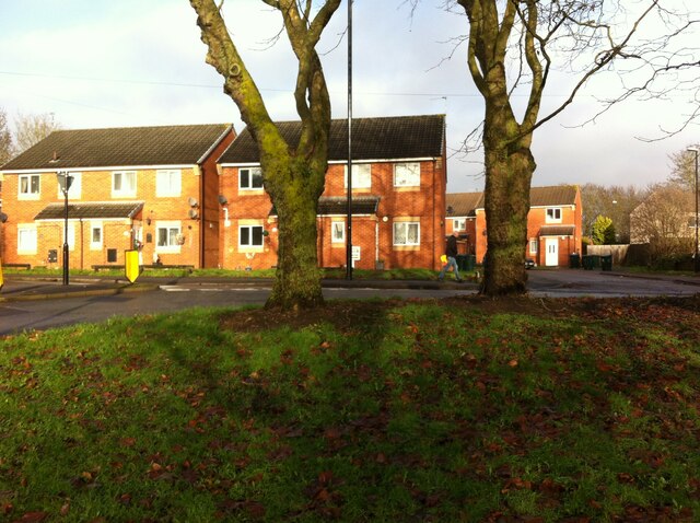
Image: © A J Paxton Taken: 24 Dec 2022
The modern Coventry district of Bell Green grew from a hamlet of that name in the parish of Foleshill, a district of farm workers, coal miners and ribbon weavers. Houses clustered around a green where Church Road (now Old Church Road), Bell Green Road, Hall Green Road and Henley Road met. They included the Bell pub, which gave its name to the settlement. The Bell was known as a place where entertainers stayed while performing at the Coventry Theatre. It was demolished in the 1960s. A street of houses, Bellview Way, was later built on and around the site. It can be seen here, viewed from the green, now a busy traffic roundabout, in the wan sunlight of Christmas Eve 2022. See David Fry & Albert Smith, The Coventry we have Lost: Forgotten Foleshill, Simanda Press, 2018, p63 & p68.
Images are licensed for reuse under creativecommons.org/licenses/by-sa/2.0
Image Location
Latitude
52.436519
Longitude
-1.475263