Thickthorn Interchange
Introduction
The photograph on this page of Thickthorn Interchange by Mark Boyer as part of the Geograph project.
The Geograph project started in 2005 with the aim of publishing, organising and preserving representative images for every square kilometre of Great Britain, Ireland and the Isle of Man.

There are currently over 7.5m images from over 14,400 individuals and you can help contribute to the project by visiting https://www.geograph.org.uk
Thickthorn Interchange
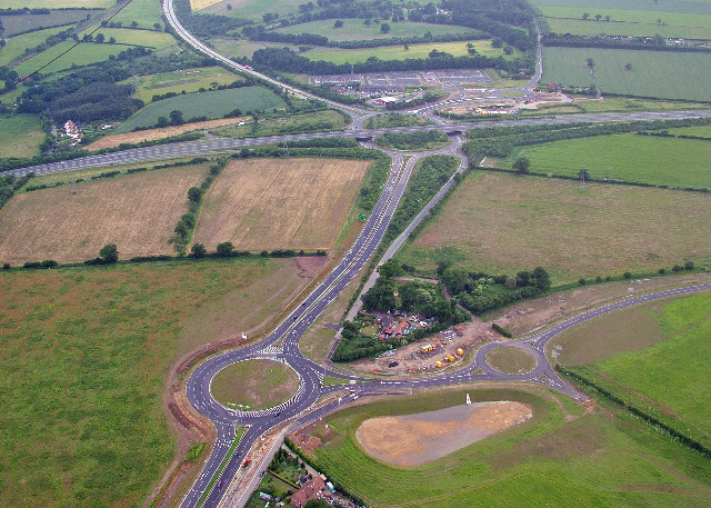
Image: © Mark Boyer Taken: 20 Jun 2005
Norwich Southern Bypass runs left to right. A11 runs top to bottom.
Images are licensed for reuse under creativecommons.org/licenses/by-sa/2.0
Image Location


Leaflet Map data © OpenStreetMap
Latitude
52.603321
Longitude
1.225256