Sailortown, Belfast (3)
Introduction
The photograph on this page of Sailortown, Belfast (3) by Albert Bridge as part of the Geograph project.
The Geograph project started in 2005 with the aim of publishing, organising and preserving representative images for every square kilometre of Great Britain, Ireland and the Isle of Man.

There are currently over 7.5m images from over 14,400 individuals and you can help contribute to the project by visiting https://www.geograph.org.uk
Sailortown, Belfast (3)
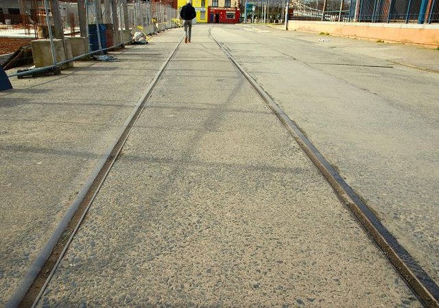
Image: © Albert Bridge Taken: 24 Mar 2008
See Image There is so little left that it is next to impossible to give any worthwhile idea of how the area looked before the demolitions. This piece of old harbour railway, in Prince’s Dock Street, and the bar and sandwich shop (background) are about all that is left. See also Image
Images are licensed for reuse under creativecommons.org/licenses/by-sa/2.0
Image Location
Latitude
54.607924
Longitude
-5.919628