Christ Church, Clapham
Introduction
The photograph on this page of Christ Church, Clapham by Ian Capper as part of the Geograph project.
The Geograph project started in 2005 with the aim of publishing, organising and preserving representative images for every square kilometre of Great Britain, Ireland and the Isle of Man.

There are currently over 7.5m images from over 14,400 individuals and you can help contribute to the project by visiting https://www.geograph.org.uk
Christ Church, Clapham
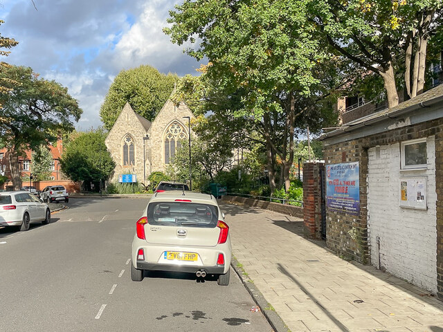
Image: © Ian Capper Taken: 7 Oct 2022
Church in Union Grove, built 1861-2, designed by the architect Benjamin Ferrey. The 1874 1:1056 map suggest that the church was built to serve an area of terraced housing and semi-detached villas, all with reasonably sized gardens. The whole area was later redeveloped as the 1935 Springfield Estate.
Images are licensed for reuse under creativecommons.org/licenses/by-sa/2.0
Image Location
Latitude
51.472095
Longitude
-0.132338