Brayburne Avenue
Introduction
The photograph on this page of Brayburne Avenue by Ian Capper as part of the Geograph project.
The Geograph project started in 2005 with the aim of publishing, organising and preserving representative images for every square kilometre of Great Britain, Ireland and the Isle of Man.

There are currently over 7.5m images from over 14,400 individuals and you can help contribute to the project by visiting https://www.geograph.org.uk
Brayburne Avenue
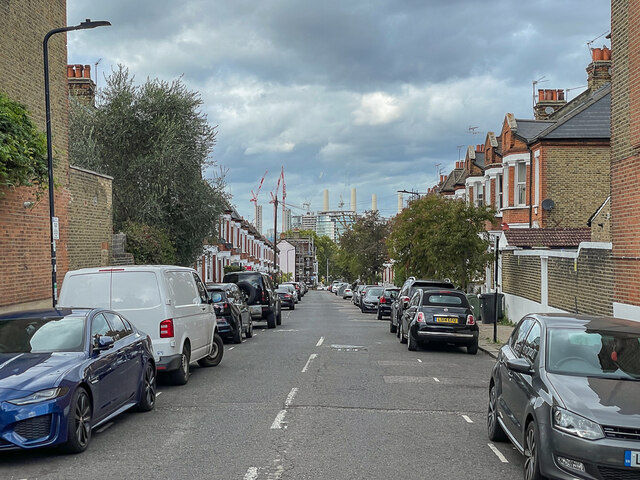
Image: © Ian Capper Taken: 7 Oct 2022
Late 19th Century residential road between Larkhall Rise and Wandsworth Road. The 1874 1:1056 map shows a large house on Larkhall Rise named Thurlow, with a garden extending almost to Wandsworth Road; the 1895 edition shows Brayburne Avenue in their place. In the background are the chimneys of the former Battersea Power Station, now being redeveloped for housing.
Images are licensed for reuse under creativecommons.org/licenses/by-sa/2.0
Image Location
Latitude
51.468448
Longitude
-0.13826