Caerwent village [1]
Introduction
The photograph on this page of Caerwent village [1] by Michael Dibb as part of the Geograph project.
The Geograph project started in 2005 with the aim of publishing, organising and preserving representative images for every square kilometre of Great Britain, Ireland and the Isle of Man.

There are currently over 7.5m images from over 14,400 individuals and you can help contribute to the project by visiting https://www.geograph.org.uk
Caerwent village [1]
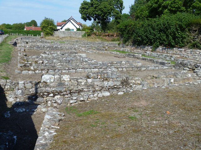
Image: © Michael Dibb Taken: 2 Sep 2022
The remains of Roman buildings. Caerwent is a village in Monmouthshire, located about 10 miles east of Newport and some 4½ five miles southwest of Chepstow. It was founded by the Romans circa AD 75 as a market town of Venta Silurum, for the defeated Silures tribe. The modern village is built around the well-preserved Roman ruins and it remained prominent as a centre for the Kingdom of Gwent after the Roman occupation and as the site of an important road crossing. Most of the village is a Scheduled Ancient Monument with details at: https://cadwpublic-api.azurewebsites.net/reports/sam/FullReport?lang=&id=3824
Images are licensed for reuse under creativecommons.org/licenses/by-sa/2.0
Image Location
Latitude
51.611613
Longitude
-2.769831